Thursday, December 6, 2012

The Seventh Wonder of England: The White Cliffs of Dover in County Kent

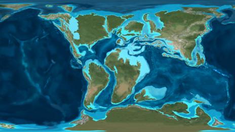
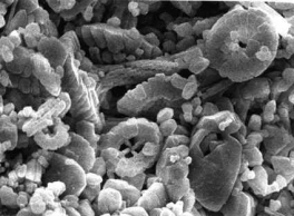
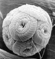
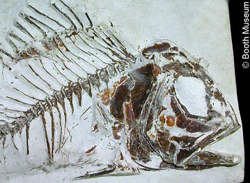
Stretching across Dover's eight mile coastline and reaching 350 feet heights, the White Cliffs of Dover's coastal landscape formed during the Cretaceous period as sea floor spreading and uplift along the mid-Atlantic ridge, along with subsiding sea levels during successive ice ages, formed the Cliffs seen today. Crushed and fossilized sea creatures make up the chalk limestone rock as frost weathering, along with possible root pressure, keep the Cliffs white as chunks from the Cliffs break off exposing newer and previously covered chalk. 
(The arrow above points to the White Cliffs of Dover's white chalk formed from crushed and fossilized shells of tiny sea creatures. Cliff collapses such as the one circled above keep the Cliffs white as newer and previously unexposed chalk is uncovered.

The Cliffs' erosional landform results from stormy winter weather and sea waves undermining the Cliffs. Under the sea millions of years ago and slowly eroding today, Dover's White Cliffs stand erect looking across the English Channel, but what does the future hold for the Cliffs? I will spend the remainder of my blog hypothesizing what the White Cliffs of Dover will look like 1,000, 10,000, and 1,000,000 years from now.


THE WHITE CLIFFS OF DOVER 1,000 YEARS FROM NOW
One source reports Dover's Cliffs erode approximately one to two inches each year, which will not dramatically change the Cliffs over the next 1,000 years.
(If the Cliffs erode at a rate of 1 to 2 inches per year  they will only move north and inland 27.7778 to 55.55556 yards,  just under one third of one mile, over the next 1,000 years. Seen and pictured above the Cliffs have plenty of land stretched across and behind to sacrifice less than a mile.
Google Images Search: "white cliffs dover" on first page)

(The Cliffs will erode only slightly over the next 1,000 years and not much will change because much land, pictured above, stretches across and behind the Cliffs.
http://www.ego4u.com/en/read-on/countries/uk/tour/dover)

I surmise erosion and cliff collapses will continue over the next 1,000 years due to frequent and recent collapses in 2001 and 2012. Frost weathering each winter and root pressure from Cliff vegetation, along with constant sea undermining, will help erode the Cliffs in the future just as they have for millions of years.
(During stormy winters, water absorbed by the Cliffs' ground freezes and exerts force, causing rock to crumble and fall and collapse.
http://noahmcdermottgeog1202fall12.blogspot.com/search?updated-min=2012-01-01T00:00:00-07:00&updated-max=2013-01-01T00:00:00-07:00&max-results=4)

(Pictured above: a prime location for both frost weathering and root pressure; water seeps through the cracks and freezes and root pressure from the vegetation atop the ground cause cliff collapses and erosion. Formations and land like this stretch across the White Cliffs of Dover and point to further erosion for the next 1,000 years.
http://en.wikipedia.org/wiki/White_Cliffs_of_Dover)

 
(Circle above displays constant sea and wave activity against the Cliffs' base, which undermines the Cliff and causes rock falls. Not quite a wave-cut notch because no sea stacks are visible along the coast of Dover, nonetheless consistent battering from waves over the next 1,000 years will help erode the Cliffs of Dover along with frost weathering and root pressure.

THE WHITE CLIFFS OF DOVER 10,000 YEARS FROM NOW
Another nine thousand years of weathering will have similar and little impact just as 1,000 years from now will. If the Cliffs continue eroding one to two inches each year only 277.7778 to 555.55556 yards of land will be lost in the next 10,000 years. Similar to 1,000 years from now frost weathering, root pressure, and sea wave impact will cause the White Cliffs to erode less than one mile inland in the next 10,000 years over Dover, England's vast landscape.
(The RED lines and end points represent how much land will be lost in 10,000 years: approximately 0.25 to 0.50 kilometres or approximately, and just under, one third of one mile. Dover and the Cliffs will be impacted but not much in 10,000 years.


THE WHITE CLIFFS OF DOVER 1,000,000 YEARS IN THE FUTURE
The White Cliffs of Dover will face bigger changes 1,000,000 years in the future than 1,000 and 10,000 years from now, but not drastic changes. Up to approximately 31.57 miles of Dover and southeast England will erode inland from the current spot of the Cliffs in 1,000,000 years.
(The BLUE lines represent how far in the Cliffs will recede if they erode one inch each year and the RED line represents how far northwest the Cliffs will move if they erode two inches per year. The change is rather significant and much of southeast England will be eroded 1,000,000 years from now.

Although the Cliffs will see significant land loss, the land's form will not change over the next 1,000,000 years. The Cliffs will only have passed west of current Canterbury, and as all of southeast England's soil northwest of Dover is comprised of chalk, the Cliff's coastline will remain chalk.
(Chalk represented by the GREEN bricks extends northwest from Dover and west of Canterbury for miles. The RED line represents where the Cliffs will be approximately 1,000,000 years in the future, just past Canterbury, with much chalk left extending northwest.
Google Images Search: link not available
Links Confirming Data on Graphic:

1,000,000 years from now seems like a long time, but in the grand scheme of Earth's geographical history it is not. Much of Dover's land will recede in 1,000,000 years' time just as in the last 1,000,000 years new land formed and older land eroded.


Sources:
- http://www.bbc.co.uk/england/sevenwonders/southeast/white_cliffs/
- http://www.whitecliffscountryside.org.uk/index.php?id_sec=1&id_sub=1
- http://blogs.redorbit.com/the-white-cliffs-of-dover/
- http://oceana.org/en/explore/marine-places/white-cliffs-of-dover
- http://noahmcdermottgeog1202fall12.blogspot.com/search?updated-min=2012-01-01T00:00:00-07:00&updated-max=2013-01-01T00:00:00-07:00&max-results=4
- http://clasfaculty.ucdenver.edu/callen/1202/Landscapes/KarCoast/KarCoast.html

Monday, November 12, 2012

Temperature, Water, and Storms in Kent

Consistent temperatures year-round and light to moderate rain showers make up County Kent's climate and weather. 2009 and 2012 exhibited cooler temperatures and heavier rainfall as thunderstorms swept across Kent.

Temperature
Latitudinal location and land-water contrasts account for temperatures in Kent. Kent averages 50.5°F year-round and is one of the warmest areas in England.
Latitude
Higher latitude means greater temperature range. Located along the southeast coast of England just above the 51° North latitudinal belt, Kent reports smaller temperature ranges than northern England. Temperatures in Kent range and rarely go below 28°F or above 78°F.

Kent climate data (1981–2010)
Month Jan Feb Mar Apr May Jun Jul Aug Sep Oct Nov Dec Year
Average high °C (°F)
7.4
(45.3)
7.4
(45.3)
10.3
(50.5)
12.9
(55.2)
16.3
(61.3)
19.3
(66.7)
21.8
(71.2)
21.9
(71.4)
18.8
(65.8)
14.8
(58.6)
10.7
(51.3)
7.8
(46.0)
14.1
(57.4)
Daily mean °C (°F)
4.5
(40.1)
4.4
(39.9)
6.7
(44.1)
8.7
(47.7)
12.0
(53.6)
14.7
(58.5)
17.2
(63.0)
17.2
(63.0)
14.6
(58.3)
11.2
(52.2)
7.5
(45.5)
5.0
(41.0)
10.3
(50.5)
Average low °C (°F)
1.7
(35.1)
1.5
(34.7)
3.1
(37.6)
4.6
(40.3)
7.7
(45.9)
10.2
(50.4)
12.6
(54.7)
12.5
(54.5)
10.5
(50.9)
7.7
(45.9)
4.3
(39.7)
2.3
(36.1)
6.6
(43.9)
(Data collected showing average temperatures in Kent from 1981 to 2010. Kent maintains steady and higher averaging temperatures year-round compared to the rest of England because of their latitudinal location. Kent recorded England's hottest temperature in 2003 at 101.3 °F. Image courtesy of: http://en.wikipedia.org/wiki/Kent)

Land/Sea
Kent's coast meets the English Channel. Kent's land heats and cools faster than the water. Less temperature range occurs in coastal climates whereas interior land in northern England produces greater temperature ranges throughout the year and suffer from Continentality.


(The water above represents the English Channel. The land represents Kent. Land heats faster and as a result the lower pressure winds from the sea carry up to the land where warm air rises up and circles back around. Image courtesy of: http://clasfaculty.ucdenver.edu/callen/1202/Climate/PressureWind/dirunal-landwater.jpg)
Water/Precipitation
On average northern England and areas with higher altitudes are wetter and accumulate more precipitation than Kent's southeast lowlands. Moderate to light rainfall affects Kent year-round, most notably between November and January. Reports from 2009 and 2012 indicate heavier rains during the summer and in the month of November respectively. Along with heavy rainfall, winds reached up to 100 mph in 2009. Torrential rainfall and strong winds led to 110 flash-flood warnings issued by the Environment Agency. Violent waves and flooded areas shut down schools and people needed rescuing from flooded cars.

Waves crash up on to the ahore at Dover
(Pictured above: the port of Dover. Caused by wind and rain, unsafe and 
rough waters cancelled departing ferries from Dover. The port of Dover 
closed for a day in 2009 and cancelled ferry services between Dover and 
France. Image courtesy of: http://news.bbc.co.uk/2/hi/in_pictures/6275725.stm)

Not all of England suffers from an overabundance of rain. Eastern and central areas in England currently suffer from drought and need rain to combat dry spells.

Storms
Lightning and Thunder
Lightning and thunder affect Kent during thunderstorms.


(Photograph taken over Deal Pier in Kent. The green circles represent stepped leaders that did not reach the ground (water in this case). The yellow circles represent the points where lightning hit its target (the water).

(Kent experiences more frequent thunder than anywhere else in England as illustrated within the yellow circle. Image courtesy of: http://metofficenews.wordpress.com/2012/04/11/why-are-we-getting-thunder-and-lightning/)

Funnel Clouds
Sightings of funnel-shaped clouds took place over Dover, Kent earlier this month with one water spout and tornado sighted as well.

(Photograph of a water spout over Dover above a large body of water. Because the funnel does not go beyond the red line and touch the ground, it is not considered a tornado. Tornadoes must come into contact with the ground. Funnel clouds are dangerous vortices of spinning air though and can reach over 200 mph. The funnel cloud is classified as a tornado when and if it hits the ground. Image courtesy of: http://www.kentonline.co.uk/kentonline/news/2012/july/31/waterspout.aspx)

(This funnel cloud in Dover did reach the ground and is a tornado. England gets more tornadoes per square kilometer than in the United States, but they are generally weaker than the ones in the U.S. Image courtesy of: http://metofficenews.wordpress.com/tag/thunderstorm/)


(Another funnel cloud spotted over Dover, Kent. Image courtesy of: http://www.kentonline.co.uk/kentonline/news/2010/july/5/tornado_hits_kent.aspx)

(Yet another funnel cloud over Kent. Image courtesy of: http://www.kentonline.co.uk/kentonline/news/2010/july/5/tornado_hits_kent.aspx)


Sources:
http://en.wikipedia.org/wiki/Kent

http://weatherspark.com/averages/28732/Canterbury-England-United-Kingdom

http://resources.woodlands-junior.kent.sch.uk/customs/questions/climate.html

http://clasfaculty.ucdenver.edu/callen/1202/Climate/PressureWind/PressureWind.html

http://clasfaculty.ucdenver.edu/callen/1202/Climate/EarthTempClim/EarthTempClim.html

http://www.dailymail.co.uk/news/article-2225877/UK-weather-Thunderstorms-gale-force-winds-set-batter-Britain-bringing-strong-seas-heavy-rain.html

http://www.independent.co.uk/environment/nature/dover-closed-as-winds-hit-100mph-1820951.html

http://www.telegraph.co.uk/topics/weather/8991395/Britain-braced-for-second-blast-of-storms.html

http://www.guardian.co.uk/uk/2011/jun/28/flood-alert-britain-storms

http://news.bbc.co.uk/2/hi/in_pictures/6275725.stm

http://clasfaculty.ucdenver.edu/callen/1202/Climate/Weather/Weather.html

http://clasfaculty.ucdenver.edu/callen/1202/Climate/Weather/tornado.html

http://www.crystalmemoriesphotography.com/photo_7648929.html

http://metofficenews.wordpress.com/2012/04/11/why-are-we-getting-thunder-and-lightning/

http://www.kentonline.co.uk/kentonline/news/2012/july/31/waterspout.aspx

Thursday, October 11, 2012

Weathering’s Impact on the White Cliffs of Dover and County Kent

Large or small, sections of the White Cliffs of Dover collapse frequently and continually keep the Cliffs white. The two most recent and major collapses occurred in 2001 and 2012.
(Photograph taken from the March 2012 collapse of the White Cliffs of Dover. The Cliffs remain white because they continually crumble and expose new rock.
http://www.dailymail.co.uk/news/article-2114912/White-Cliffs-Dover-Thousands-tons-chalk-crash-sea-large-section-collapses.html)


Frost weathering causes the Cliffs' collapses. An example of physical weathering, frost weathering causes rock fractures and breakage. Both the 2001 and 2012 collapses occurred during cold winter seasons and 2012's March collapse "has been blamed on February's chilly weather. Rain has been absorbed by the chalk and has then expanded as it freezes" (http://www.dailymail.co.uk/news/article-2114912/White-Cliffs-Dover-Thousands-tons-chalk-crash-sea-large-section-collapses.html).
(Circle above and yellow line represent ground that absorbs rain water.
(Rain water absorbed in ground above the Cliff freezes in cold winter months. The frozen water exerts force on the rocks of the Cliff and crumbles.

(Rock crumble resulted from frozen water expanding within Cliffs' chalk and caused collapse.


Although frost weathering is the main reason for the Cliffs' collapses, joints and other weathering processes help cause rock breakage and fracture. None of my sources mentioned joints in rocks, but frost weathering only occurs where joints exist.
(Three vertical lines within the yellow circle illustrate joints in the Cliff. The Cliffs' many joints absorb water deep in the rocks, causing major collapse when the water freezes along and in the Cliff.

I suspect root pressure from grass on and atop the Cliff filled joint fractures and broke sections of rock. Plant roots did not cause the same damage and rock crumble as frost weathering, but did help expand rock fractures along the Cliff. I hypothesize the grass roots growth and eventual rock breakage helped frost weathering damage the Cliffs.
(Much grass resides on the ground atop the Cliffs and the sides of the Cliffs. Grass roots help cause rock fracture and rock breakage.)
(More grass on and above Cliffs.)
(Grass all along the Cliffs of Dover, helping break rock from root pressure.)
(Shrubs and trees growing atop the Cliffs. A likely hotspot for root pressure and rock breakage.


Along with weathering, the Cliffs erode about a half inch each year. The movement and transport of weathered material 10-20 million years ago affected County Kent's "major geographical features...a series of ridges and valleys...the results of erosion of the Wealden dome."
(View of a ridge and valley across the Kent Weald. http://en.wikipedia.org/wiki/File:WealdfromDowns.JPG)


The Wealden dome formed during Alpine movements and "consists of an upper layer of Chalk above successive layers of Upper Greensand, Gault Clay, Lower Greensand, Weald Clay, and Wealden sandstone." Ridges and valleys formed because "the exposed clay eroded faster than the exposed chalk, greensand, or sandstone" (http://en.wikipedia.org/wiki/Kent).
File:KentGeology.JPG
(A detailed look at Weald's layers:
- Chalk: white, porous sedimentary rock and a form of limestone
- Greensand: greenish colored sediment sandstone
- Gault Clay: a stiff compact clay soil
- Weald Clay: Cretaceous sedimentary rock


Sources:


Thursday, September 20, 2012

Formation and Fossils

The White Cliffs of Dover were formed during the Cretaceous period 150 to 60 million years ago. The separation of the supercontinent Pangea occurred around the same time as the Cretaceous period. As the sea floor diverged and spread, magma seeped through the mid-ocean ridge from the asthenosphere in great quantities causing sea-levels to rise, submerging parts of continents in warm shallow seas.


(magma seeping through the mid-ocean ridge
 image courtesy of:
 http://mrborden.wordpress.com/2012/01/22/sea-floor-spreading-and-the-mid-ocean-ridge/)

A map of the Earth in the Cretaceous Period
(the light blue represents land submerged during the Cretaceous period
 image courtesy of: http://www.bbc.co.uk/nature/history_of_the_earth/Cretaceous)

Cretaceous is Latin for chalk, which is why the Cliffs are white. Chalk, limestone, is a biological sedimentary rock. Lime mud (from skeletons of plankton, the Coccolithophores) accumulated on the sea floor as more and more sediment built up.

Coccoliths under microscope                   Coccolith under microscope
    (magnified look at chalk coccoliths, discs                           (a single coccolith)
     that form the spherical skeleton of
     Coccolithophores)
Images courtesy of:

As the sedimentary rock deposited in layers called strata, the sea floor subsided and the Cliffs were uplifted. The heat and pressure hardened, or lithified, the rock creating what we see of the Cliffs today.

(image courtesy of:
http://en.wikipedia.org/wiki/White_Cliffs_of_Dover)

The White Cliffs contain fossils that range from shark's teeth and many types of sponges to brain corals. The Cliffs of Dover are great for palaeontologists to study fossils. Much of museum collections were established during the Victorian era as scientific study blossomed. Additionally, there was demand for chalk during the industrial revolution in the 19th Century. Chalk is ideal for holding fossils because the rock is hard enough to preserve them in their three dimensional state, but soft enough for palaeontologists to expose and collect.

Fossil fish Hoplopteryx lewesiensis
(chalk fish)

 Fossil starfish Metopaster parkinsoni
 (chalk starfish)

Images courtesy of:
http://www.discoveringfossils.co.uk/chalk_formation_fossils.htm


Sources:
http://en.wikipedia.org/wiki/White_Cliffs_of_Dover
http://www.discoveringfossils.co.uk/chalk_formation_fossils.htm
http://en.wikipedia.org/wiki/Cretaceous
http://clasfaculty.ucdenver.edu/callen/1202/Battle/Build/PlateTectonics/PlateTectonics.html
http://clasfaculty.ucdenver.edu/callen/1202/Battle/Build/EarthMaterials/EarthMaterials.html
http://www.bbc.co.uk/england/sevenwonders/southeast/white_cliffs/
http://www.dover-kent.co.uk/places/white_cliffs.htm

Wednesday, August 29, 2012

Introduction

Hello All!

My name is Noah McDermott and I am a student at the University of Colorado at Denver. I am a senior and am taking Geography 1202 this Fall Semester 2012. I have decided to study the Geography of the White Cliffs of Dover and County Kent, located in South East England, for my blog.

Let me start by saying I am a huge fan of anything British. I also love film and television. I grew up on BBC miniseries, mysteries, and shows, so one of my greatest joys is watching a BBC program or series. For as long as I can remember I have always wanted to live in London, England. I was fortunate enough to visit London when my parents took me on a graduation trip through Europe in 2009. Unfortunately, our time in London only lasted five days and left me wanting more. There are so many places in England and Great Britain I would love to visit and that is why I have chosen to study the White Cliffs of Dover and County Kent. Who knows, I may want to live in County Kent after studying the geography. Not only will these amazing cliffs and the beautiful land be a great way to learn about geography, but I will also be able to learn more about England and all the wonderful places I can and want to visit in the future. All while having some fun!

Check back in soon to explore and learn about the physical geography of the White Cliffs of Dover and County Kent!

(The White Cliffs of Dover)


(The White Cliffs of Dover as seen from France)


Background Image Courtesy of: http://www.geolocation.ws/v/P/454776/the-white-cliffs-of-dover/en
Images Courtesy of: http://en.wikipedia.org/wiki/White_Cliffs_of_Dover